Maps Page on Thailand
Outline
- Physical Environment
- Thailand Physical Map
- Thailand Vegetation Map
- Soil Resources of Thailand
- Weather & Climate
- Average Maximum Temperature of Thailand
- Mean Annual Rainfall of Thailand
- Mean Annual Relative Humidity of Thailand
- Human Environment
- Population Density of Thailand
- Ethnic Groups of Thailand
- Economic Activity of Thailand
- Road maps
- Roads of Thailand
- Roads of Bangkok
- Expressways of Thailand
- City Maps
- Major Cities of Thailand
- Map of Bangkok
- Map of Rayong
- Urban Transportation Maps
- Bangkok Metro Map
- Bangkok Bus Map
- Thailand Train Map
- Tourist Maps
- Interactive Thailand Map
- Bangkok Attractions
- Koh Tao Tourist Map
1 Physical Environment
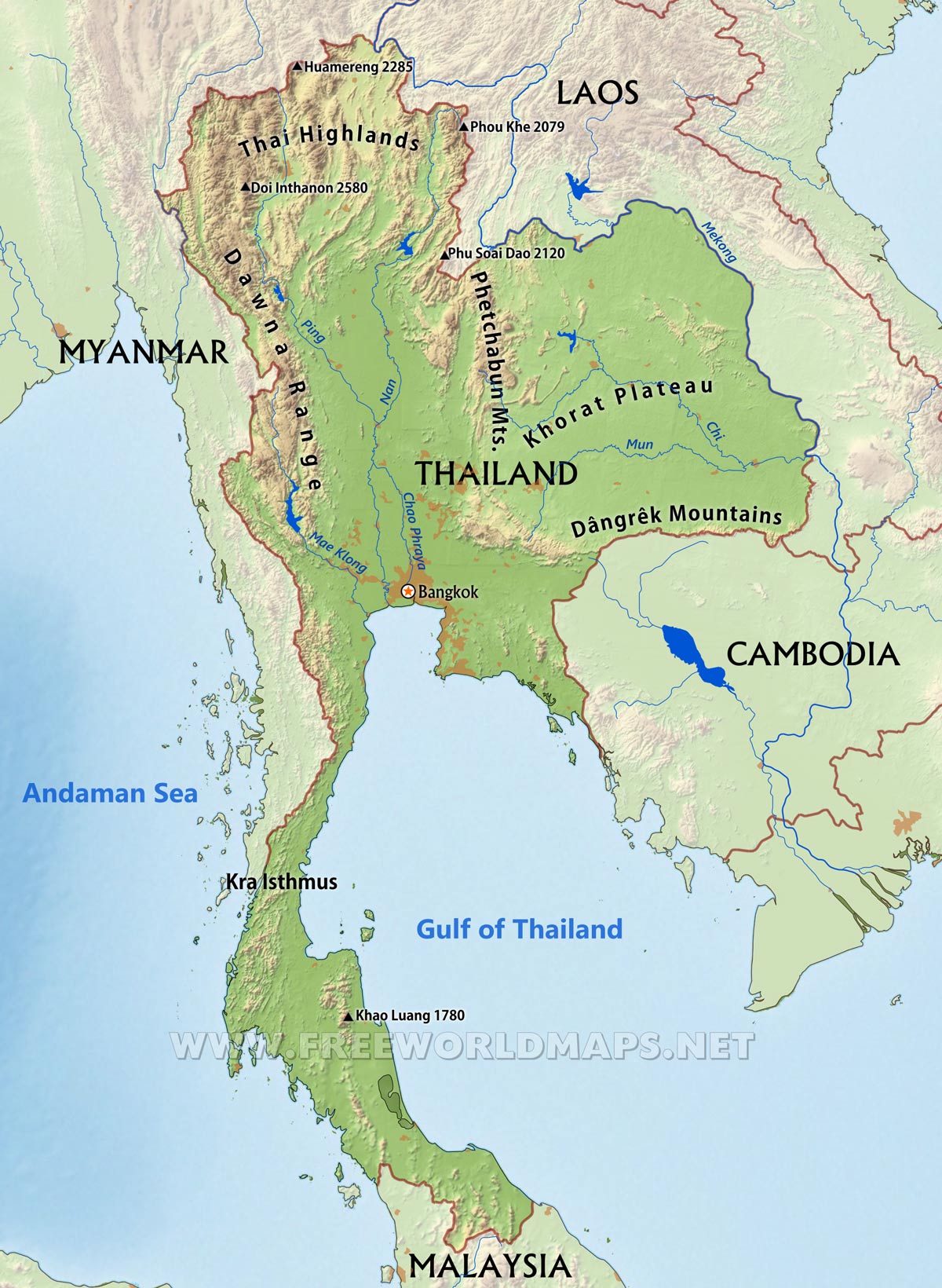
Physical Map 1: This map shows the physical landforms such as mountains, lakes, highlands and plateaus.
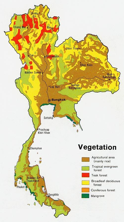
Physical Map 2: This map shows the vegetation that grows in Thailand and where at in the country they grow
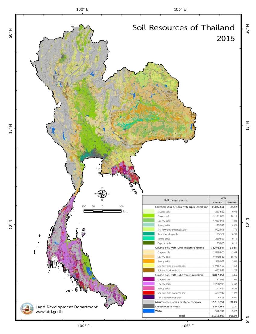
Physical Map 3: This map shows the different soils of Thailand and where they exist.
2 Weather & Climate
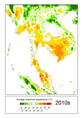
Weather Map 1: This map shows the average highest temperatures of Thailand during the 2010's in Celsius.
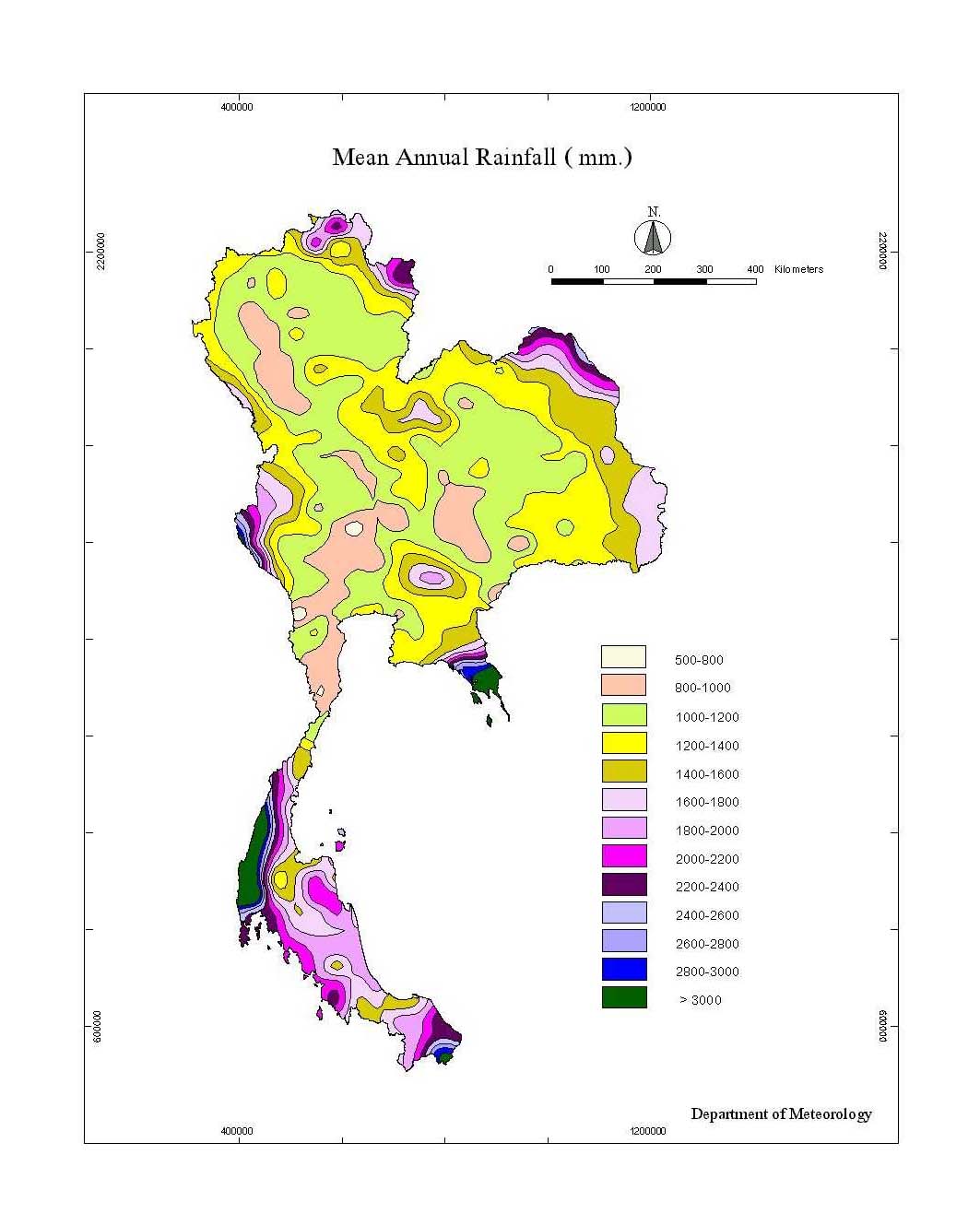
Weather Map 2: This map shows the average annual rainfall in millimeters in Thailand.
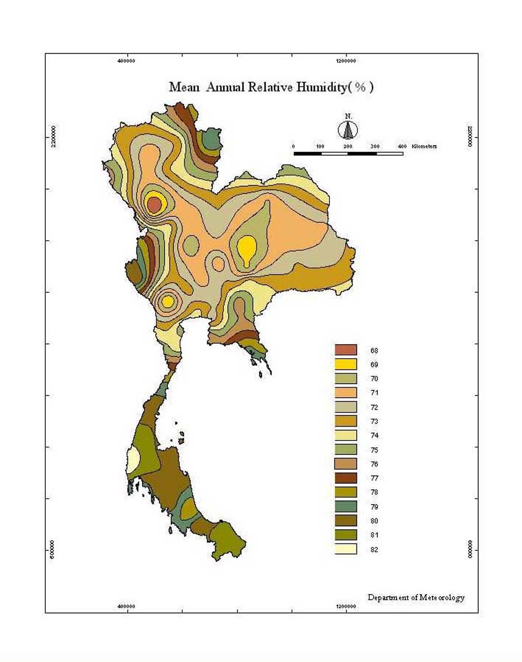
Weather Map 3: This map shows the average annual relative humidity percentages in Thailand.
3 Human Environment
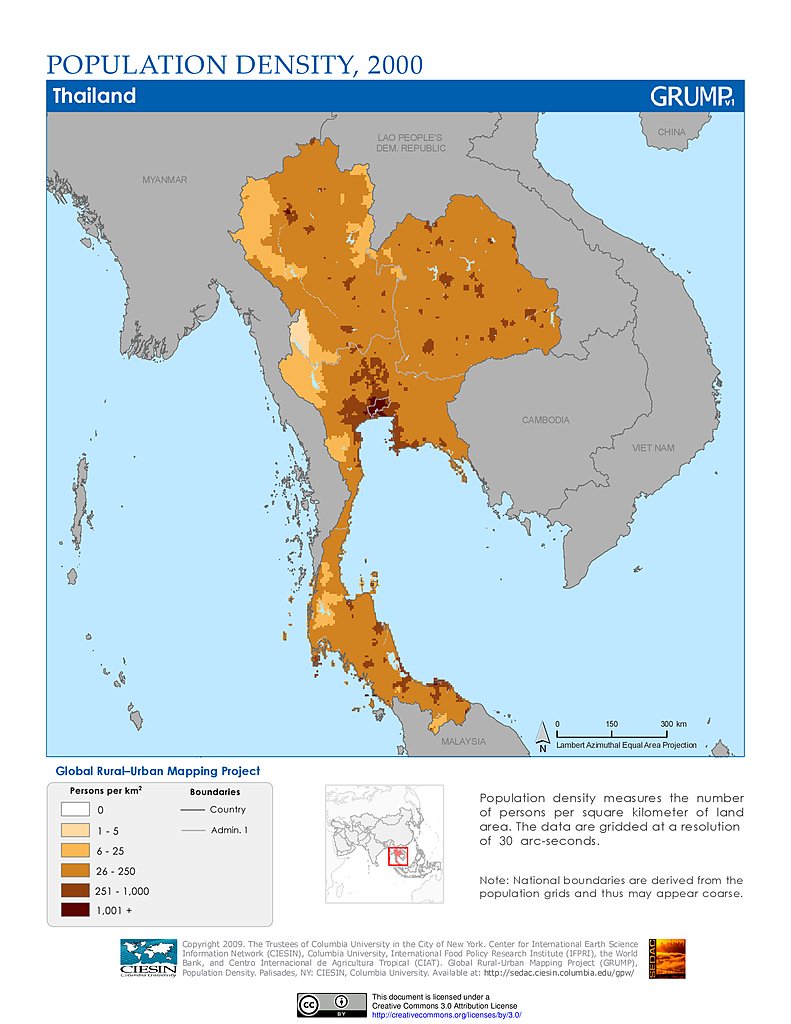
Human Map 1: This map shows the population density of Thailand, in persons per kilometers. However, this map is from the year 2000, so the population density may have changed over the past 20 years.
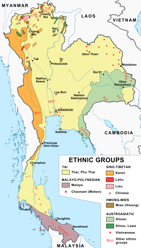
Human Map 2: This map shows the 5 major ethnic groups of Thailand, as well as their subgroups.
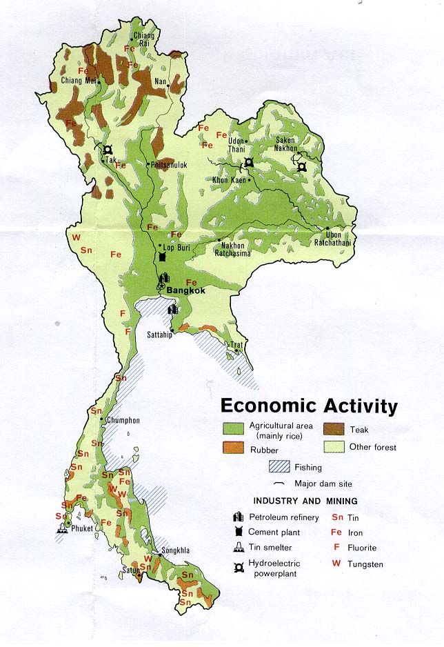
Human Map 3: This map shows the major economic activities of Thailand and where they take place throughout the country.
4 Road Maps
Road Map 1: This map shows roads throughout Thailand, however there are no differences shown between expressways, main roads, and other roads.
Road Map 2: This map shows roads throughout Bangkok, Thailand's capital.With this map there is no legend so there is no way to know what are main roads of the cities and what are expressways.
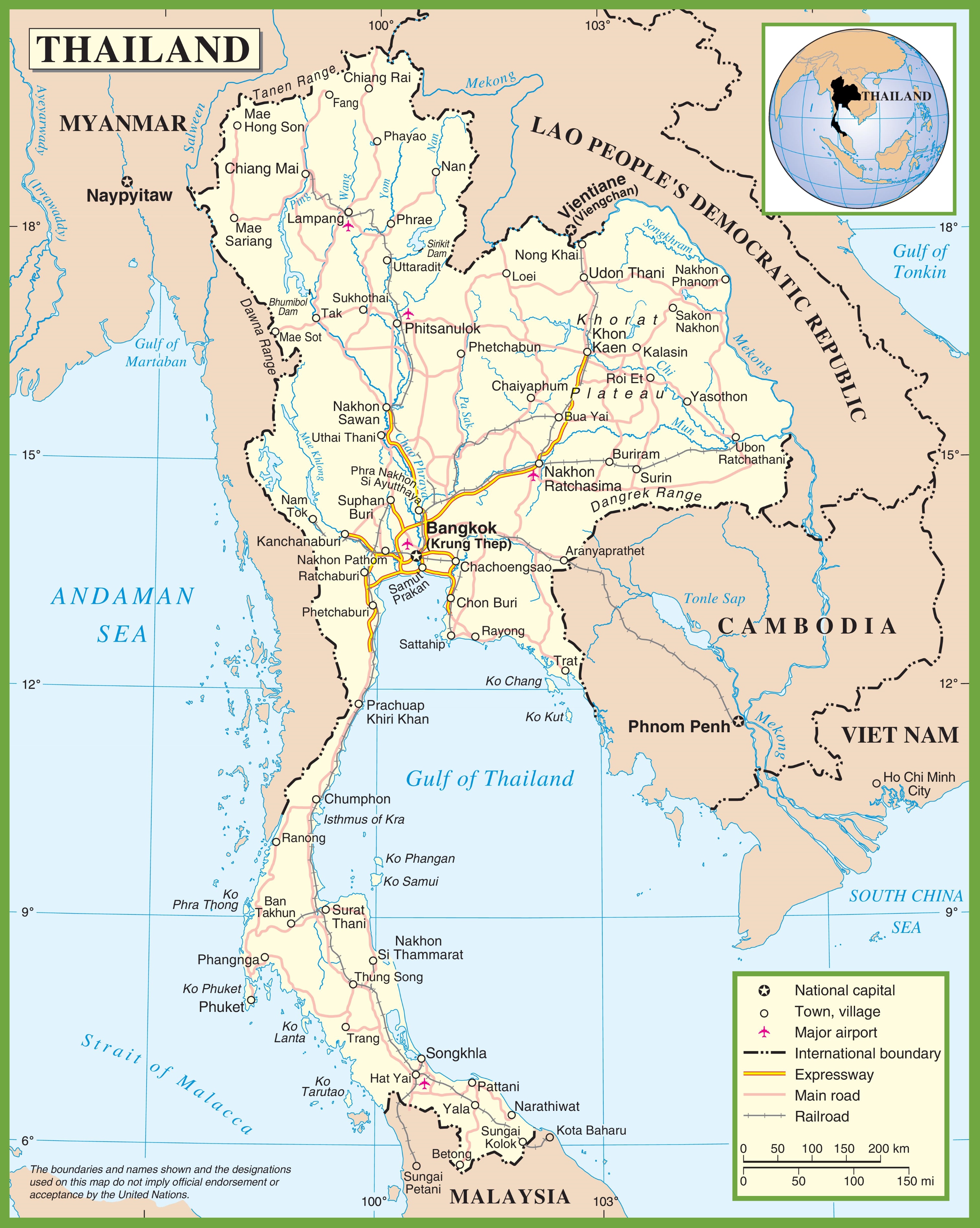
Road Map 3: This map shows roads throughout Thailand, however this map makes distinct differences between expressways, main roads, and railways.
5 City Maps
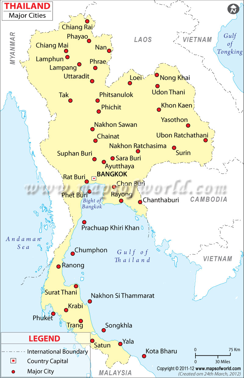
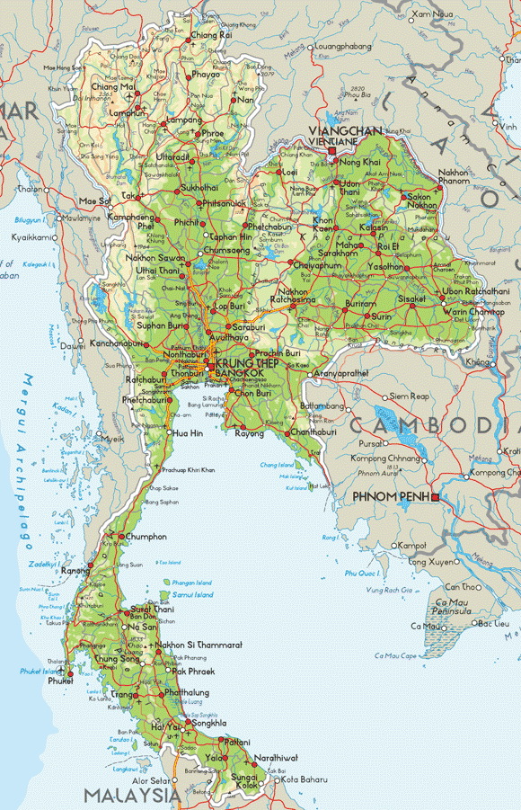
City Map 1: This map shows the major cities of Thailand, however besides a distinction between Bangkok and the other cities, there are no differences being shown in terms of population, major road ways, etc..
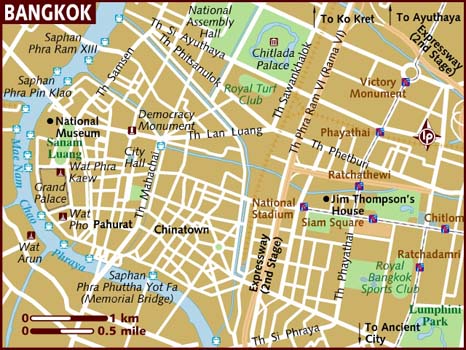
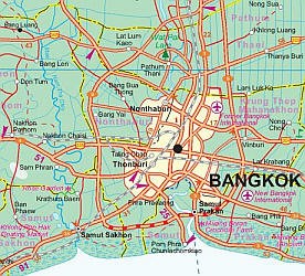
City Map 2: This map shows Bangkok, Thailand's capital, showing the roads, monuments, and other significant parts of the city.
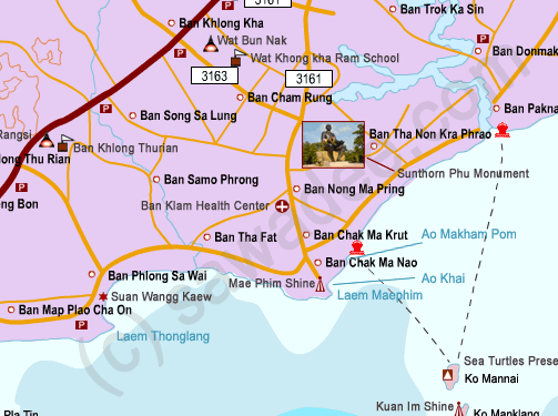
City Map 3: This map shows Rayong, which is a major City in Thailand, this map (like the Bangkok one) shows us roads, monuments, and other important parts within the city.
6 Urban Transportation
Transportation Map 1: This map shows the Metro system of Bangkok, and shows the different routes of the Metro system.
Transportation Map 2: This map shows the bus system of Bangkok, and shows the different routes of the bus system.
Transportation Map 3: This map shows the train routes throughout Thailand, as well as bus services and ferries.
7 Tourist Sites
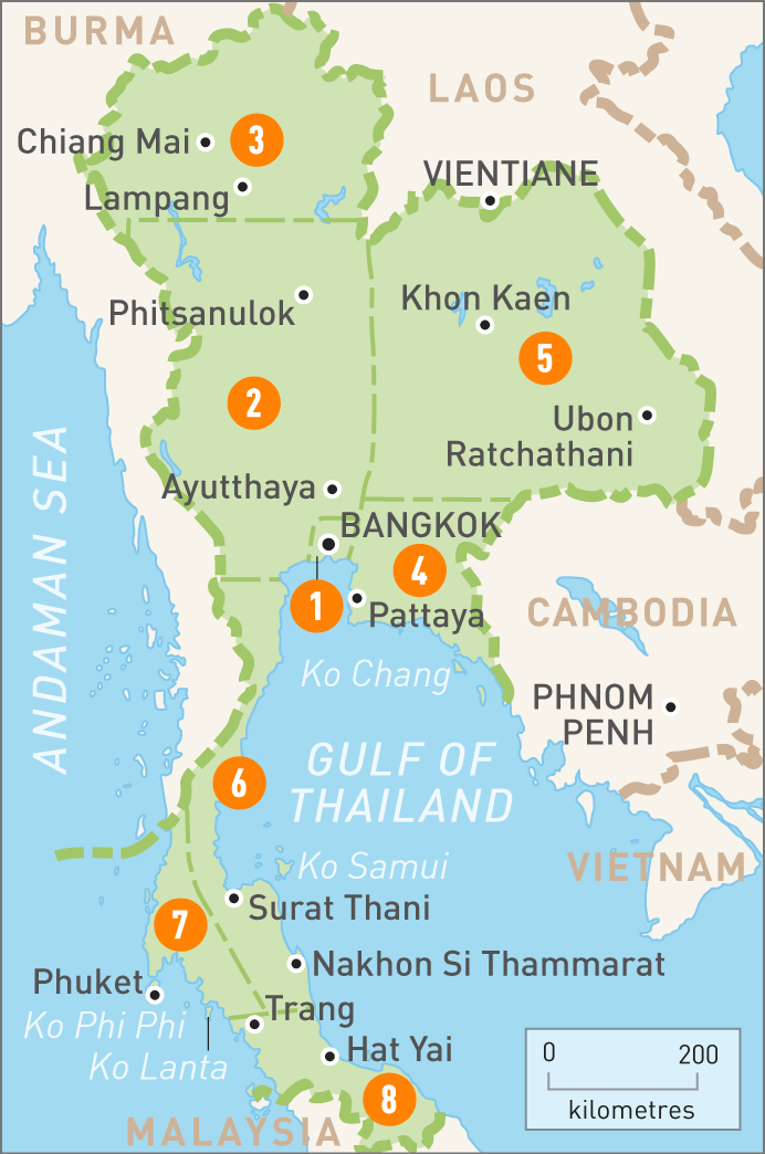
Tourist Map 1: This map of Thailand splits the main land into parts, and on the website you can go to it's actually interactive, where if you click on one of the numbers it will show you different tourist areas in that specific area.
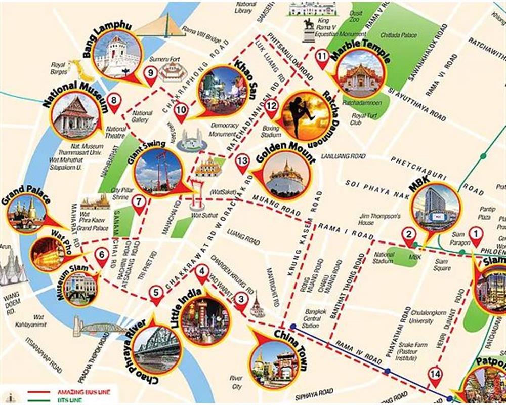
Tourist Map 2: This map of Bangkok shows different spots in the city that people can visit, such as museums and monuments.
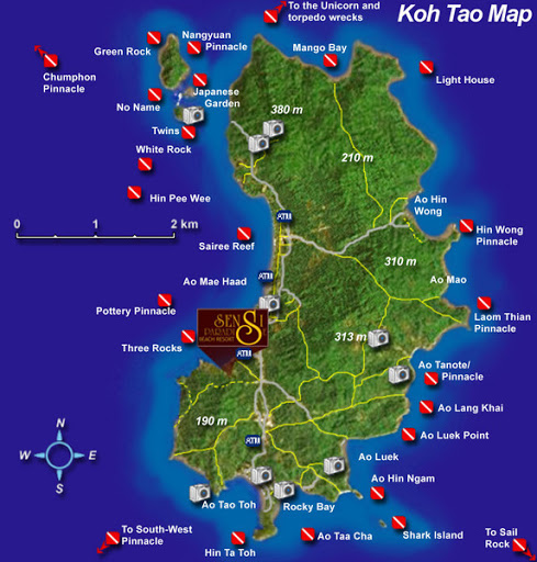
Tourist Map 3: This is a map of Koh Tao, which is an island of Thailand, and the different spots that people can visit/popular tourist attractions representated by a camera.
Submitted by Whitney Beets on 3/6/2020.